Tidal vs. Deep‑Water Access in Maine
November 22, 2025
November 22, 2025
Water at your doorstep can mean two very different lifestyles in Maine. If you are shopping waterfront in Casco Bay, you will hear terms like tidal frontage and deep‑water access, and they are not interchangeable. Choosing the right type of shoreline affects your boating, your dock plans, and even how you spend a quiet evening on the beach at low tide. This guide translates the essentials so you can compare properties with confidence and ask the right questions at showings. Let’s dive in.
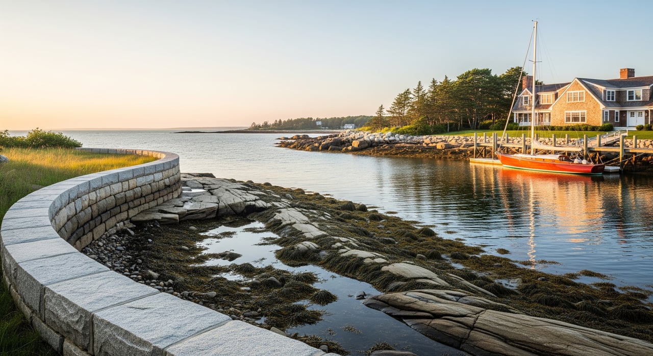
Tidal frontage means the shoreline is exposed at low tide and covered at high tide. You might see intertidal flats, rocky ledges, or beach that is dry for hours each day. Boats can sit aground at low tide unless they are on a float in deeper water or on a mooring placed farther out.
Deep‑water access means there is enough depth to navigate at low tide for the vessel you plan to use. The key reference is depth at mean lower low water, often shown as MLLW on nautical charts. If you want reliable access at all tides, match the water depth at MLLW to your boat’s draft, plus a safety margin.
Two related terms matter when you evaluate a site:
If a federal or state channel is authorized and maintained near your property, it can support deeper access. Maintained channels are dredged to a stated depth, which makes navigation more predictable.
Your boat’s draft drives what is practical. Skiffs need far less depth than keelboats or larger powerboats. If your shoreline is shallow at low tide, you will likely rely on a mooring placed in deeper water and use a dinghy to reach it. Proximity to a maintained channel can make transits easier and safer for larger vessels, especially at low tide.
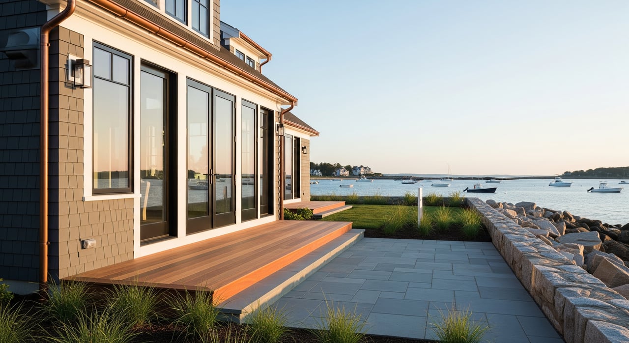
Fixed docks can be difficult or unusable at low water if they were not designed with local tides in mind. Floating docks rise and fall with the tide and often improve access on tidal shorelines. Gangway length and angle matter. Very low tides call for longer gangways to keep slopes safe. Trailer ramps may be usable only during higher tides, which affects your launch schedule.
Mooring location sets your usable tide window. Depths can vary across a mooring field, and some areas in Portland Harbor and busy Casco Bay coves use permits, fees, and waitlists. A private or deeded mooring is a material benefit to verify during due diligence. Remember that a mooring usually requires a dinghy transfer, while a slip keeps your boat at the dock.
Tidal currents near narrow channels and headlands can be strong at certain stages of the tide. They affect docking, mooring loads, and anchoring. When wind and tide oppose each other, wave action can build and make boarding more challenging. Local knowledge is valuable before you plan regular runs at low water.
Shorelines near shoaling channels can need periodic dredging to maintain access. Dredging is regulated and can be costly. Dock systems, piles, and shoreline protection like riprap require inspection and routine maintenance. Exposure to storm waves and ice also influences long‑term costs.
Tidal flats can be beautiful for beach walks and tidepooling at low water. They also change the feel of your waterfront during part of the day and may come with natural odors when mudflats are exposed. Flood zones, storm surge, and road access during coastal flooding affect insurance and building requirements. Ask for the FEMA flood designation and any known flood history.
Casco Bay’s coastline is complex, with ledges, islands, and narrow channels that change depth quickly over short distances. Portland’s waters are busy with recreational and commercial use, and harbors are regulated with mooring fields and active marinas. In outer Harpswell and select island coves, you may find natural deep water, while other shorelines are very tidal.
Use authoritative sources when you evaluate a property:
Docks, ramps, piles, and dredging usually require municipal approvals, state permits, and sometimes federal permits. Timelines and conditions can shape what you are allowed to build or modify. Moorings often require permits with fees and rules on placement and number.
Use this list to gather the right information before you offer.
Start with your intended use. If you plan to keep a larger powerboat or a keelboat at the property, prioritize deep‑water access at MLLW and an easy route with a reliable controlling depth. If you are happy with a mooring and a dinghy ride, a tidal shoreline may suit you and offer wonderful low‑tide recreation. In every case, verify depth with recent data, speak with the harbor master, and review permits and maintenance records before you commit.
When you are ready, reach out for guidance and a curated shortlist of Maine waterfront homes that match your lifestyle and boating needs. With boutique representation and deep local knowledge, we can help you navigate this decision with confidence. Connect with Elizabeth Banwell to begin.
Stay up to date on the latest real estate trends.
Real Estate
Exploring the Value of Home Warranties in Your Area

Real Estate
Discover the Most Commonly Asked Real Estate Questions in Your City

Real Estate
Transform Your Space with Innovative Gadgets and Cutting-Edge Solutions
Real Estate
Must-Ask Questions for Homebuyers in Your City
Real Estate
Transform Your Outdoor Space Into a Relaxing Oasis

Lifestyle
Transform Your Space with Dynamic Color Choices
I have logged many years working in, exploring, and enjoying many of the communities that comprise Maine's 16 counties. I have developed particular knowledge of the following areas: Greater Portland, including Brunswick and Bath; Knox, Waldo & coastal Washington counties.